Knowledge Base
Reading a Facility on the Twin Map
A Digital Twin opens as a live plan of a real building. Rooms, walls, doors, stairs, lifts and equipment are separate objects you can click, filter and route between, level by level. The plan and your registers are the same records, so an asset you click on the map is the asset in your Bill of Materials.
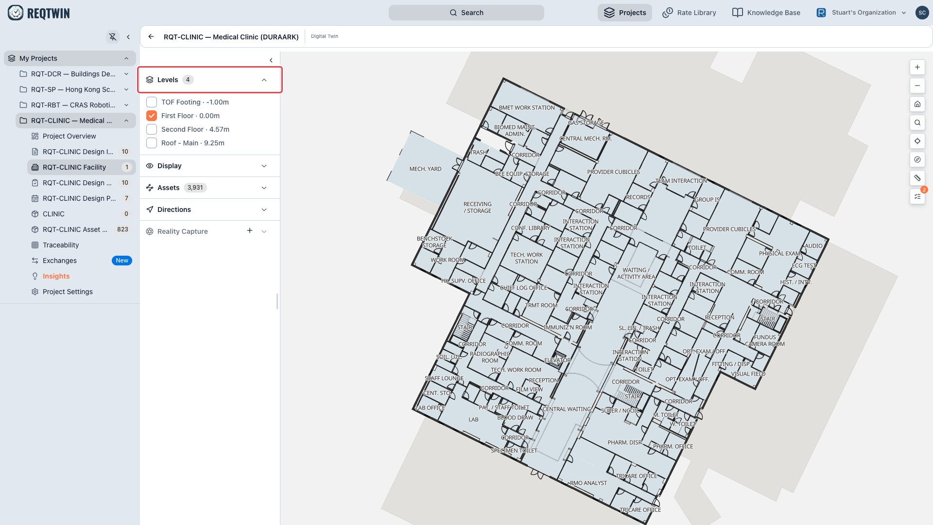
RQT-CLINIC open on the Twin map: the project's documents on the left, the Twin's own panel beside it, and the floorplan filling the pane.
The left panel, top to bottom
Each section carries a badge, so a collapsed panel still answers its own question.
| Section | What it does | Its badge |
|---|---|---|
| Facilities | Every building on the site. Only appears on a multi-building document | Shown of total |
| Levels | Storeys, with names and elevations. Tick levels to cut the building | How many levels |
| Display | What gets drawn: Rooms, Details (walls, doors, stairs, railings, landings), Source, Basemap | Feature count per layer |
| Assets | Equipment, grouped by discipline or system | Count on this level |
| Directions | Indoor wayfinding | Route quality |
| Reality Capture | Scans, panoramas and point clouds | Scan coverage |
Levels counts the whole building and Assets counts the level you are on. Hover either badge and it names its own scope.
Getting around
| Control | What it does |
|---|---|
| Zoom in, Zoom out, Fit to facility | The usual |
| Rotate map | Read the building along its own grid, or reset to north |
| Go to room or asset | Jump by room number or EAM ID |
| Go to coordinate | Drop a marker at a longitude and latitude |
| Measure | Click to lay down points, right-click or Escape to finish |
The plan does not tilt. Every distance on it is a plan distance, and a tilted view would let a measured length change with the camera. Measure reports the horizontal span and says (plan) so you know. The point-cloud viewer's own ruler reports slope distance instead, which reads longer on anything that climbs.
Fixing something you spot
Click an asset and its inspector opens with an Edit asset action for admins and editors. It edits the record in place, so a correction made on the plan is a correction in every register that asset appears in.
Stairs that read like stairs
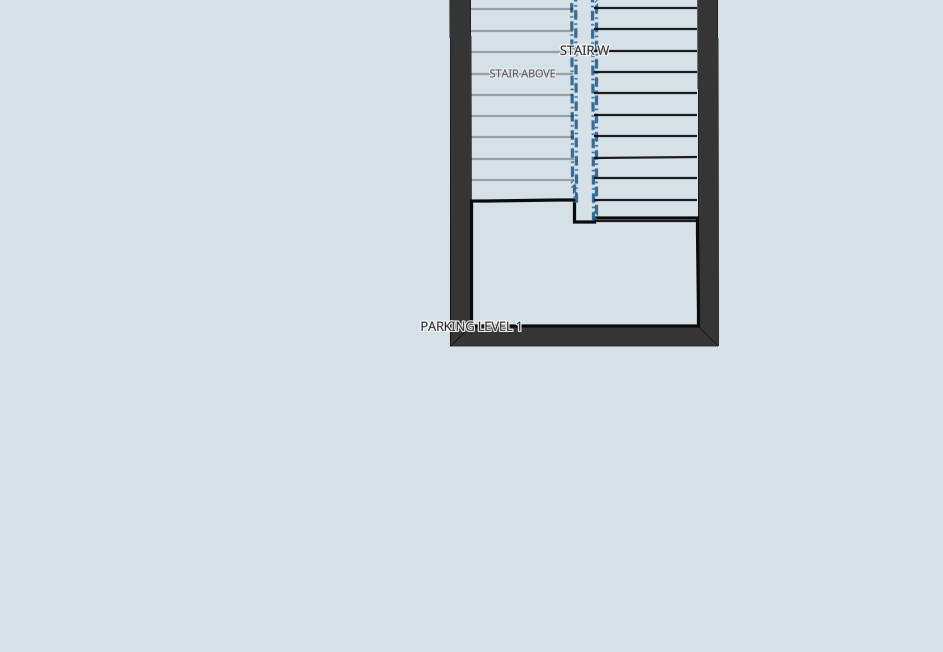
A stair landing drawn as a plan surface at the top of a flight, with a solid black railing outline running its edge.
Landings and railings are drawn as real fabric, in the same fine black ink as walls and doors, because architectural detail belongs in the plan's own vocabulary rather than being coloured as a special object.
Where the model authors a landing or a railing, you get the real one. Where it does not, ReqTwin can add one to the building-code rule instead, so a fall hazard is never simply left undrawn. Which you are looking at is never a guess: select the element and its panel says Real (as-built) or Synthesized (not as-built).
What is overhead, and why it matters
Some of what a level contains sits above head height: bulkheads, soffits, the underside of a stair passing over you. That fabric is drawn faintly and labelled. It is worth trusting, because Directions depends on it. A soffit is something you walk under, and treating it as a wall would sever the corridor beneath it.
Known limits
Railings and landings are only as good as the model. A file with none authored has none to draw.
Guarding is only added where there is real stair geometry to work from.
Map tiles are cached, so a geometry change may take a moment to appear.
For where each drawn element comes from, see "How Architectural Detail Reaches the Twin Map".