Knowledge Base
Creating a Digital Twin from IFC or GeoPackage
Drop in a model file and you get a working building: rooms, walls, doors, stairs, lifts and every piece of equipment, ready to click, filter and route through. There is no extract-then-review step. Upload, and the twin is there.
What you can upload
| Format | Extension | Positioning |
|---|---|---|
| IFC | .ifc | You can set an anchor, or leave it and fix it later |
| GeoPackage (AIIM) | .gpkg | Positions itself from the file's own coordinate system |
Uploading
From a project, create a new document and choose Upload file.
1. Pick IFC or GeoPackage (AIIM). The file picker and the drop zone follow your choice, so a wrong file is refused before it costs you an upload. 2. Answer What is this file?
| Answer | Use it when | What it asks next |
|---|---|---|
| New building | Your first import, or a building you have not loaded before | A name for the twin |
| New version | A newer export of a building you already have | Which building it supersedes |
| Another discipline | The same building drawn by a different trade | Which facility to merge into |
New version is only offered once the project holds a building the file could supersede, so on a first import the question is a genuine two-way choice rather than a three-way one with a dead option in it.
3. Name the twin. A version or a merge takes its target's name automatically. 4. On an IFC, optionally set Anchor latitude, Anchor longitude, Rotation and Building code. A GeoPackage asks for none of these: the file declares its own coordinate reference system, so there is nothing to place by hand and the dialog says so instead of offering fields that would be ignored. 5. Press Upload and ingest.
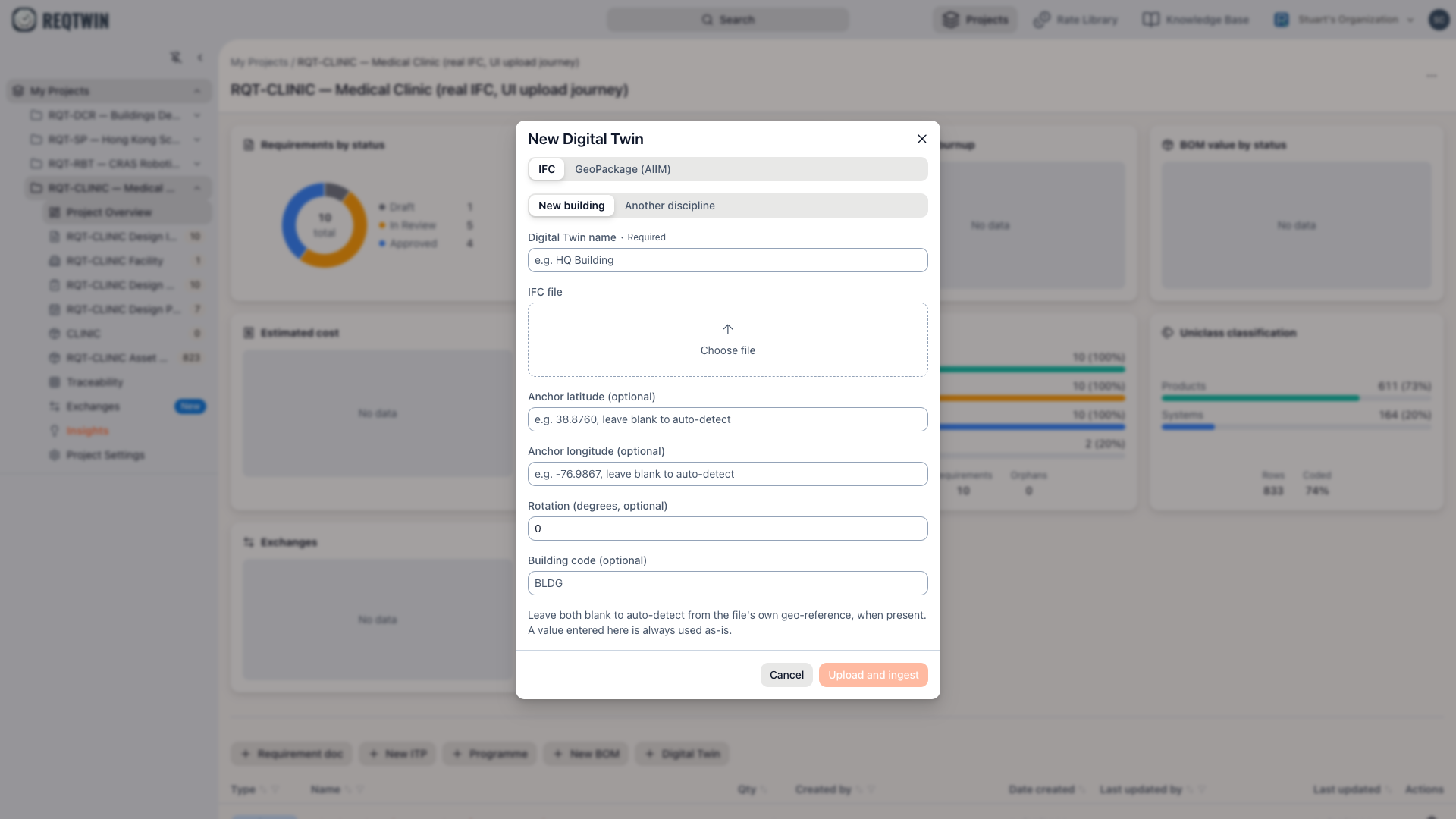
The upload dialog set to IFC, asking what the file is: a new building, a new version, or another discipline.
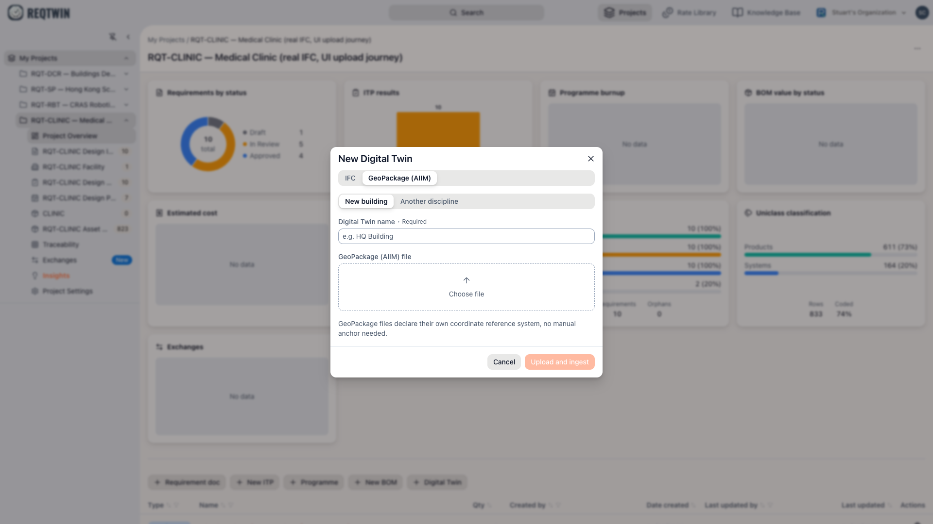
The same dialog switched to GeoPackage (AIIM). The file picker and drop zone follow the source type.
The question in step 2 is about the file, not about the system, because the two costly mistakes are both misreadings of intent: loading a revision as a brand-new building duplicates it, and pointing a revision at the wrong building overwrites the wrong one. The version list names real buildings with their current version, not just document names, so you can tell them apart.
When the import finishes you get a checklist telling you whether it came in cleanly and what changed since last time. See "Reading the Import & Version Report".
After the upload
An IFC import gives you levels, rooms, walls, doors, windows, stairs, railings and assets, all as separate objects. Indoor Directions needs one more step: build the navigation graph from the Directions panel.
Revit and PDF
Neither is offered yet, and they are held back for the same reason: a half-tested import can save geometry that looks right and is not, which is far more expensive to unpick later than to prevent now.
| Format | Where it stands |
|---|---|
| Revit (.rvt) | Not a separate importer. A .rvt is converted to IFC and then travels the ordinary IFC path. Held back until that conversion has been run end to end on a real file |
| PDF floorplan | A real pipeline, unfinished. It has never written a row to a customer database |
Both are being finished rather than abandoned, and turning either on is a one-line change when it is ready.
Known limits
The dialog checks file size in the browser as a sanity check, not as a hard backend limit.
Versioning and merging only target facilities already in the same project.
A brand-new facility has no navigation graph until you build one.